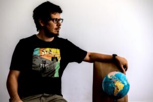
Hey there! I’m Martín Fernando Ortiz, a Geography graduate currently pursuing a master’s in Statistics and Geomatics. I’m passionate about the geospatial industry, covering everything from cartography to spatial analysis, remote sensing, geostatistics, and app development.
In essence, my work involves creating solutions from geospatial information, merging skills like data wrangling, spatial analysis, automation, loops, statistics, and data viz.
I choose open-source software not just for trends or costs but to democratize knowledge and technology access. It’s more than a tool—it’s a philosophical and political stance.
I’m especially into urbanism and mobility, tackling them from a geographical angle. Geocomputation is key for addressing city accessibility, urban land valuation, demographics, cultural access, and transportation planning.
Beyond these topics, I’m keen on promoting and strengthening open-source software and exploring new technologies.
This space is where I communicate and produce content differently from social media. I’ll share professional aspects, reflections, ideas, works, and critiques. It’s not just a showcase; it’s a documentation of my work and materialization of ideas.
Welcome!