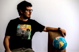
MARTÍN FERNANDO ORTIZ
INFORMACIÓN GENERAL
EDUCACIÓN
Maestría en Generación y Análisis de Información Estadística - Universidad Nacional de Tres de Febrero
2019-Actualmente
Posgrado en Big Data e Inteligencia Territorial - Facultad Latinoamericana de Ciencias Sociales
2020
Licenciatura en Geografía - Universidad de Buenos Aires
2009-2017
Técnico en Electrónica- Colegio Pio IX
1998-2003
EXPERIENCIA LABORAL
External Consultant - Facultad de Filosofía y letras
2019 - currently
The objective of this consulting work is to build an instrument to monitor social behaviours around solid waste stations. My main responsibilities in this work are related with the production of quantitative information (indicators, statistics analysis, surveys design, spatial analysis)
Data Analyst - Data Cultura
2019 - 2021
Data Cultura el área de estadística del Ministerio de Cultura de la Ciudad de Buenos Aires. El trabajo se basó en el manejo y producción estadística de la actividad cultural en la ciudad. Principales tareas: extracción y generación de datos referidos a la actividad cultural de la ciudad. Análisis estadístico, producción de visualizaciones (Dashboards, mapas interactivos, gráficos). Las principales herramientas utilizadas fueron: QGIS, Carto, R y powerBI.
Socio - Cooperativa Cambalache
2017-2019
Principales tareas: análisis espacial, diseño de IDE (Infraestructura de Datos Espaciales), Planificación Estratégica,
diseño cartográfico, investigación en tecnologías geoespaciales. Coordinación de proyectos y equipos de trabajo. Docente y tutor en Cursos SIG modalidad presencial y virtual.
[dvresume title="External Consultant CEDESU" subtitle="2018-2019"]
In this consultancy we made a movility analysis of Buenos Aires City. For more information.
My main resposabilities:
- Design and Management of spatial data bases
- Spatial Analysis
- Cartographic Design
Geodatos - Impronta IT
2014-2018
At Impronta IT I participated in differents geospatial projects for various companies (CH2MHill, TGS, ARSAT, Buenos Aires City Government). The nature of this different workenvironments gave me a rich experience in GIS from the design of spatial databases, to geometry edition, process automatization, etc.
Projects:
• Sidewalk managment system for Buenos Aires City Government
This project had the main objective to developt a sidewalk system to managment the state of sidewalks in the city (arrangments, claims, breakups). My main responsabilities were: developt an algorithm to make a sidewalk cadastre, ETL of spatial data bases, spatial analysis.
• GIS Specialist for TGS
The main responsabilities were: managment information technology and GPS field survey, maintenance and control of GIS databases, ETL, make automatization process with model builder.
• GIS for managment Red Federal de Fibra Óptica (ARSAT)
The main objective of this project was to implement a system to monitor the state of the federal network of optic fiber (REFEFO). The Refefo is one of the biggest projects Argentina telecommunications. It brings internet conections to the hold country from La Quiaca in northern Argentina to Usuahia in the Patagonia. My responsabilities were plans digitalization, import CAD files to GIS, make geospatial databases loading technical information of the network with the Software OSP Insight
• Soil characterization project for CH2M – Peruvian Amazon
My main responsabilities were: supervision and coordination of GIS team, management information technology and GPS field survey, maintenance and control of GIS Databases, upgrade th internal manuals, training materials and systems documentations, developt digital elevation models
GIS Analyst - Buenos Aires City Goverment
2012-2014
Main responsabilities: edition of geospatial data, CAD sketch of transit signals, cartography, etc.